Source: Tencent.net
The earliest Qinhuangdao was only a fishing village. After a long period of development, it gradually had the same urban form as street, road, Li, and Hutong. According to the “Names of places in Haigang District”, Chaiheshi Street, Qingzhen Street, Hongyili, Yangjia Hutong are the earliest batches of streets.
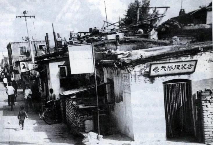
Qingzhen Street was built in 1883.
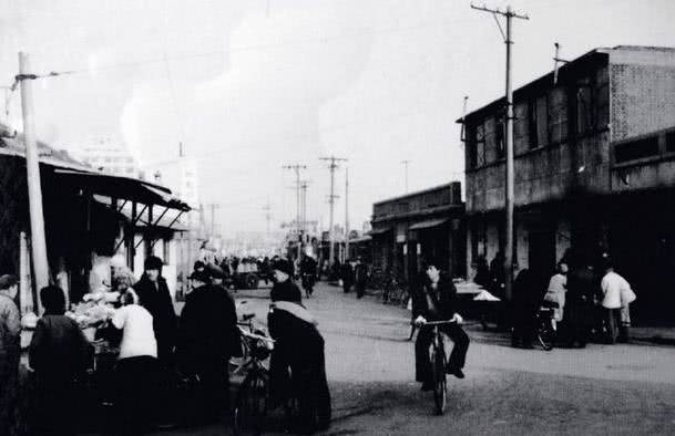
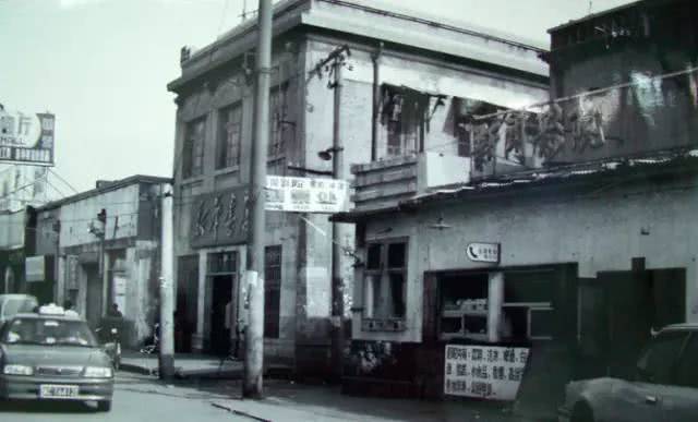
The picture shows the Qingzhen Street junction in 1978.
At that time, some Shandong and Cangzhou people who had been on the journey to the northeast lived here and built simple earthen houses. Therefore, they also had these streets.
In the later period, with the opening of commercial ports and the construction of ports and docks, more and more streets and trading shops were built. Thus, the business was gradually prosperous.
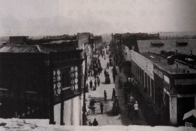
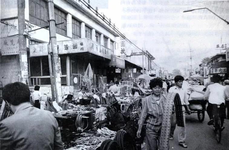
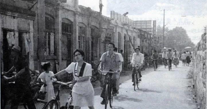
Qinhuangdao Street View in the 1950s
In 1924 (the 13th year of the Republic of China), there were six or seven hundred shops in Qinhuangdao. The names of the recorded streets and lanes have also been developed from the Great Wall Road, South Road and Chaoyang Street to dozens of large and small streets.
By 1935, Haiyang Road had developed into a more prosperous business district. At that time, there was a large low-lying land in the area of Yushi Street, and the area to the east of Gaosheng Street was the pothole land.
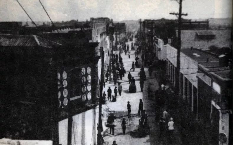
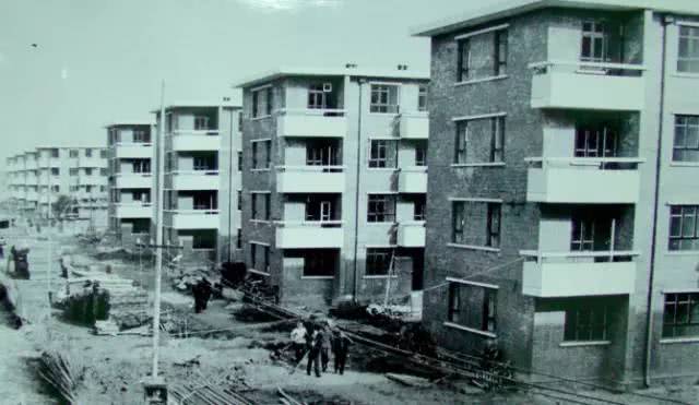
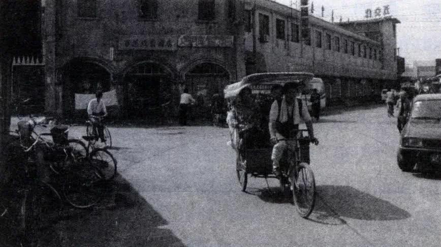
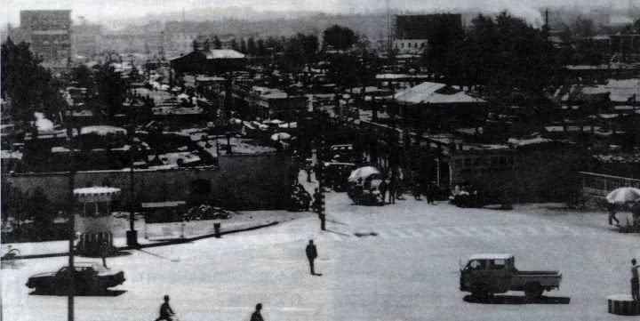
Street view of the west end of the Great Wall Road in Haigang District in the early 1960s
In 1949, there were 148 streets with names in Haigang District. By the beginning of the 1990s, there were 295 streets, roads, Li, and Hutong recorded with name in the same district.
Chaoyang Street, located in the middle of Haigang District, was built in 1911
Southern area of the Rail and Northern area of the Rail
Southern area of the Rail and Northern area of the Rail are decided in the geographical sense. In 1949, there were three districts in Qinhuangdao City, one in the south of the railway, and two in the north of the railway. This railway is the Jingfeng Railway. In 1916, the railway moved southward, with a large curvature running through the urban area of Qinhuangdao, and the city was divided into north and south.
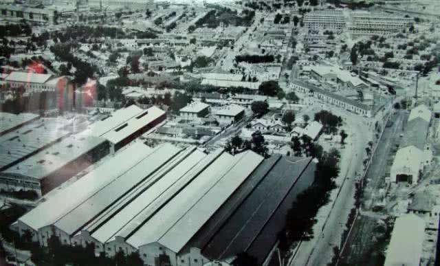
Old appearance of Dao Nan (South of the rail)
“Dao Nan - Kailuanlu Road”
In 1905, Kaiping Changdao Road, the first cement road in Qinhuangdao was built. This is the later Kailuanlu Road. In 1912, after Kaiping Coal Mine and Luanzhou Coal Mine jointly established the Kailuan General Administration of Mines, Kaiping Changdao Road was renamed as Kailuanlu Road.
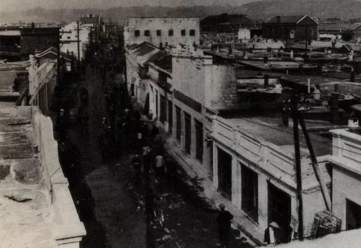
East Section of Kailuanlu Road around 1912
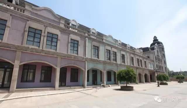
The total length of Kailuan Road is about 2.2 kilometers. It has been artificially divided into three sections: North, Middle and South. The former Kailuanlu Road is the most prosperous in the middle section, and the European architecture on both sides is also very eye-catching.
The northern section of Kailuanlu Road mainly includes Yingshou Li, Yanshou Li, Fushou Li, Laogong Li and Renhe Li, etc.
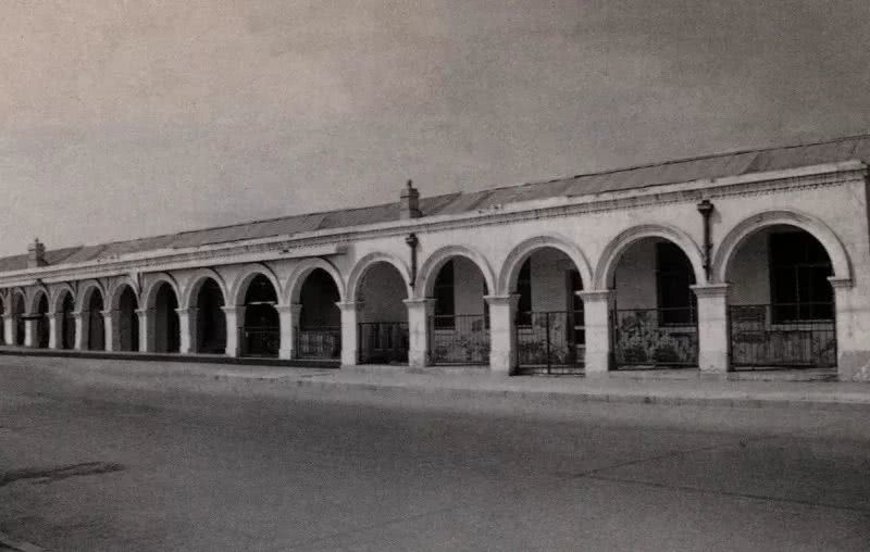
Shops on Kailuanlu Road
Part of Quanfulou--the famous restaurant in Qinhuangdao
The mountain section of the southern end of Kailuanlu Road is called “Nanshan Street” with Qinhuangdao Customs and China Post Office. The southern section of the mountain section is also known as “Tonggang Road” because it runs directly to the port. There are various shops and catering stores for the ships and crew on both sides of the road.
The former post office on Kailuanlu Road in the Haigang District
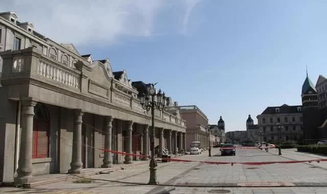
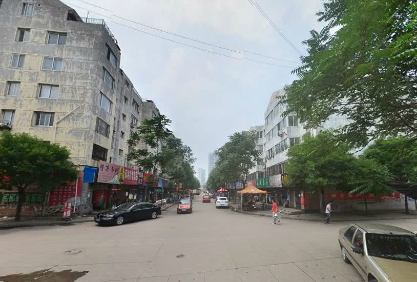
When the bustling has become a thing of the past, today’s Kailuanlu Road is being demolished and rebuilt. It is necessary to preserve the imprint of history and fight forward in the torrent of the times. This is development.
Old building reserved on Kailuanlu Road
The district renovation project was first started in 2003, and the renovation project was officially launched in 2009. This is the reconstructed historical and cultural street of Kailuanlu, but due to the simultaneous rebuilding of the surrounding areas, Kailuanlu Road has not yet officially opened.
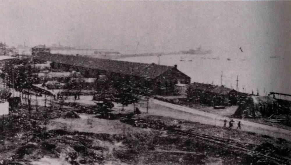
『Gangzhuanlu(Cylinder brick road)』
Cylinder brick road is named after the brick paving on the road. It has been more than a hundred years since the laying of the brick road, and now the cylinder brick with the “KMA” logo can still be found in the Qinhuangdao Port Museum.
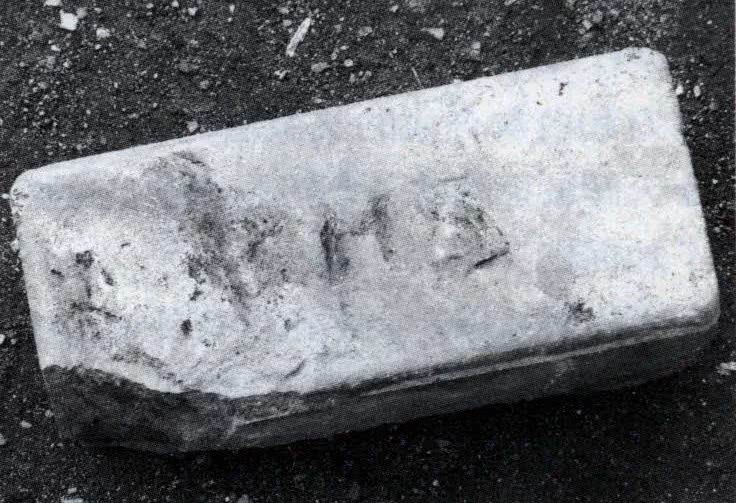
Clinker bricks found on the cylinder brick road in 2006 engraved with the letters “K.M.A”
In 2012, Hebei Port Group built the Port Museum. They specially used the collected clinker bricks to lay a new “cylinder brick road” and restored the bustling history.
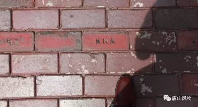
Port Museum ground with open clinker bricks
Dao Nan was once the city center of Qinhuangdao. Jiefang Li, Haibin Road, Guangming Road, Bohai Road, Penglai Road, Qingyun Li and other streets are witnesses of the past and present. They also carry the future promises. This may be the charm of growth of the future.
Jiefang Li
Daobei
Yujing Street, Qingzhen Street, Hongyi Li, Fanhua Market, Chaoyang Street, Xinhua Street, Haiyang Road, Hebei Street... The history of the development of streets in Daobei, cannot be introduced within a moment. . Today we will talk about some of them~
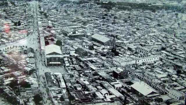
Urban area of Qinhuangdao in old days
Chaoyang Street Department Store, Qinhuangdao City, 1977
Yujing Street
As the name implies, it is the place where the well is encountered. The ancients said: “The business must be on the market.” Yujing Street gradually developed to the south, with a case of Yujing Hutong and Yujing road (four in total). To the west of Yujing Street, in 1903, there was a street in the south and north, called Yujing Zhengjie Street (later omitted as Zhengjie street).
Former People’s Hospital
In 1911, there was Chaoyang Street in the southwest of the Street, and there was a Daode (moral) street parallel to the west of the Street. In 1914, two more streets were created in the south and north of the Daode (moral) street - Xiqian Street and Xihou Street.
Kangle Li in 1978
The earliest building in Qinhuangdao
What happened to Yujing Street, which was the first street? Today, it is only possible to speculate on its general location based on the surviving Taiping Street and Dongchang Street (formerly East Street) in the 1990s (should be in the present Qinhuang Xiaoqu Community).
Former Xinhua Bookstore
“The Great Wall Road”
The Great Wall Road is named after the Great Wall Railway Station. The Great Wall Railway Station is located in the southeast of the original Xiaodongzhuang. From the west of the Great Wall Railway Station to the original Fish Market Street, there is a southeastward dirt road, which was later named the Great Wall Road.
The Great Wall Road was built in 1913
Located in the middle of the Haigang District
The Great Wall Road is the main road in the old city. Before the liberation, most of the people living near the Great Wall Road were the most common urban civilians. “Maybe it is because the people living here are mostly civilians. In the memory of the old people, there are very few shops with names on this street. Most of them are small shops and small vendors.”
The Great Wall Road in the early days of the liberation
On the fish market street, west of the Great Wall Road, there are stores such as Rongji Meat Shop, Chunfasheng(grocery) and Zhouhuapu (Department Store), which are still in the memory of the old people. Zhu Changsheng still remembers that when he bought fish and prawns, they were sold on the strings of wild grass and iron bars.
Old Bridge Crossing at the Great Wall Road, Haigang District
The appearance of the fish market street also has a relationship with a bridge - the Sandaoqiao bridge. Sandaoqiao bridge was once located in front of the National Aquatic Products Department (commonly known as “Fish Market”) on the Great Wall Road;
The former Great Wall Road Commercial Street, Haigang District
Due to the geographical location, fishermen who often fish by the sea came here to sell fish, so a fish market was formed on the south side of the bridge site, and then there was another fish market street.
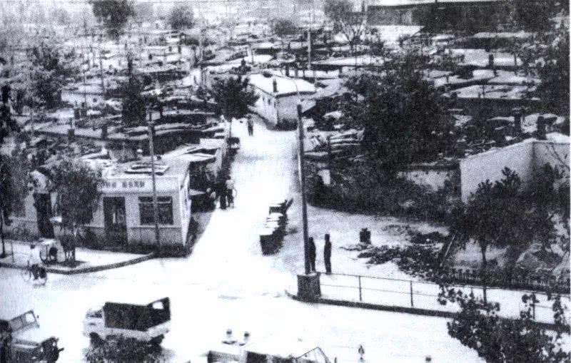
A sight of the original Great Wall Road in Haigang district

In 1962, the urban trade market including the Great Wall Road and the “North Market” was opened. In the late 1990s, the old city on the east side of the National Road was transformed, and the Qinhuang Xiaoqu Community was built. The Great Wall Road was moved south and renamed as the Great Wall Street.
Great Wall Street
Hongyi Li
Today, Hongyi Li, where the halal food lane is located, is also one of the earliest streets in Qinhuangdao. In 1990, due to the reconstruction of the old city, Hongyi Li was dismantled into Xingfu Li
.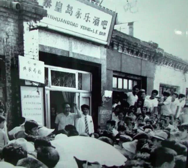
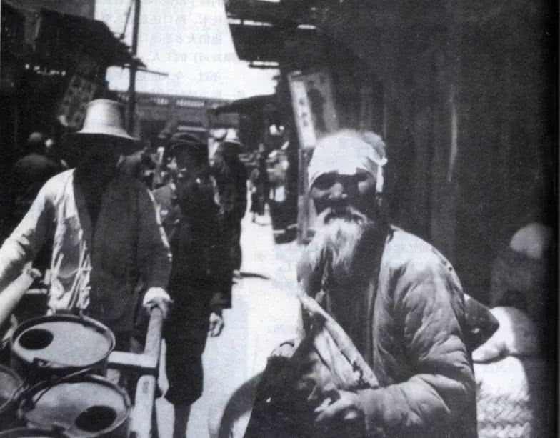
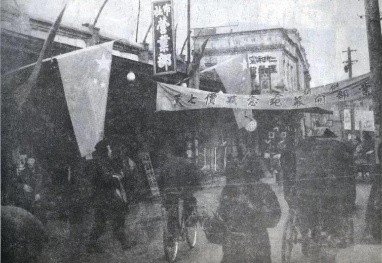
The first bar in Qinhuangdao in 1983
“Haiyang Road”
According to the textual research, Haiyang Road was gradually formed on the abandoned roadbed of the “Dock-Tanghe Station Railway Special Line” built in 1899. Since it runs directly to Haiyang Town, Haiyang Road was named.
Haiyang intersection in the Haigang District in 1987
Before the liberation, Haiyang Road was a large driveway for peasants to enter the city. The rural people often took the firewood, grain, fruits and vegetables to the city to exchange money.
Intersection of Wenhua Road and Haiyang Road in 1996
In the 1950s and 1960s, the sale of water became a scene on Haiyang Road. In the winter, the water sprinkled by the water trucks every day made Haiyang Road form two roads - one side is the road, the other side was an “ice road” due to the blocked sunlight.
The former Haiyang Road in Haigang District
After the liberation, Haiyang Road was built into a highway. In the early 1980s, the commercial department of Qinhuangdao City began to build commercial outlets at the eastern end of Haiyang Road. The old people recalled that for a year or two, on Haiyang Road, like today’s Sun City, people sold things in the stands and did business during the day.

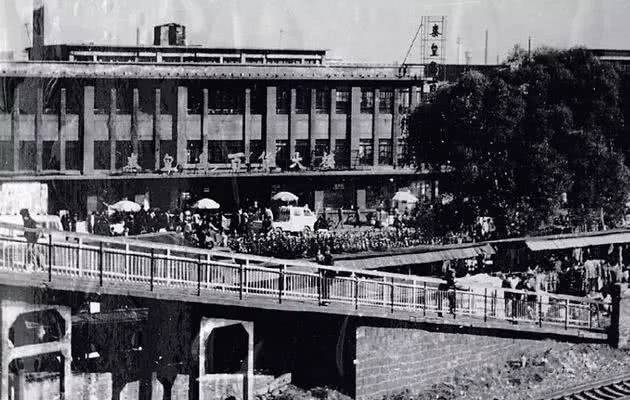
Tanghe Bridge
Old photo, new view record the changing of times
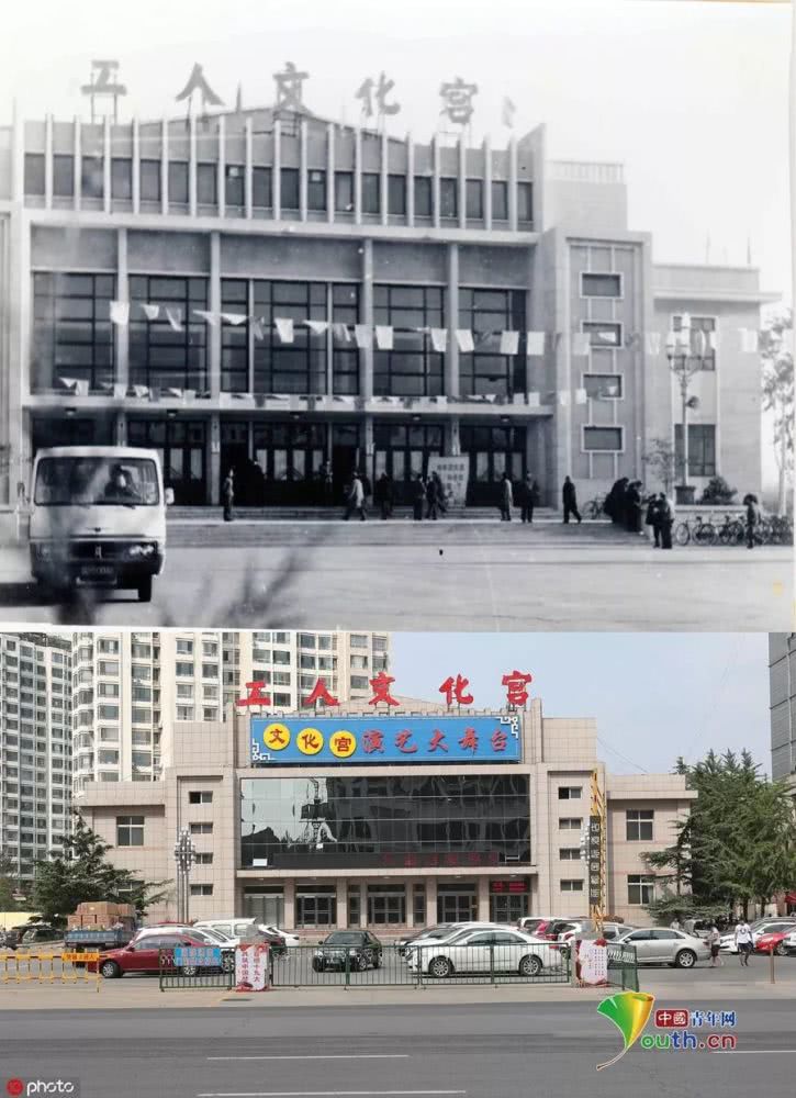
Above: Workers’ Culture Palace in the 1980s (Provided by the Qinhuangdao City Archives)
Below: Qinhuangdao Workers Culture Palace on August 20, 2017 (Photo by Cao Jianxiong)
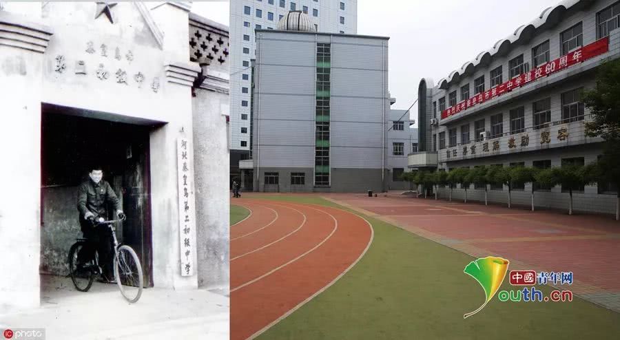
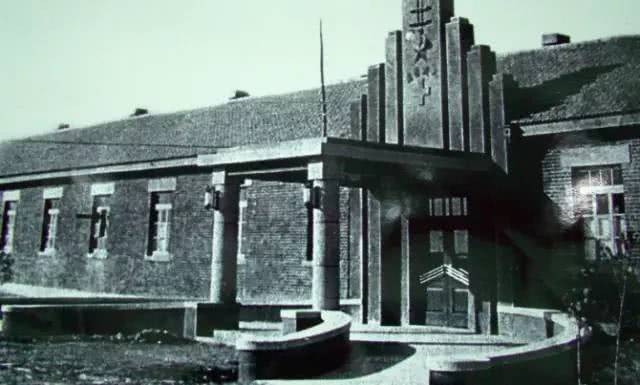
Left: The oldest school gate of Qinhuangdao No. 2 Middle School from 1954 to 1956 (Provided by Qinhuangdao City Archives)
Right: Qinhuangdao No. 2 Middle School on May 6, 2014 (Photo by Cao Jianxiong)
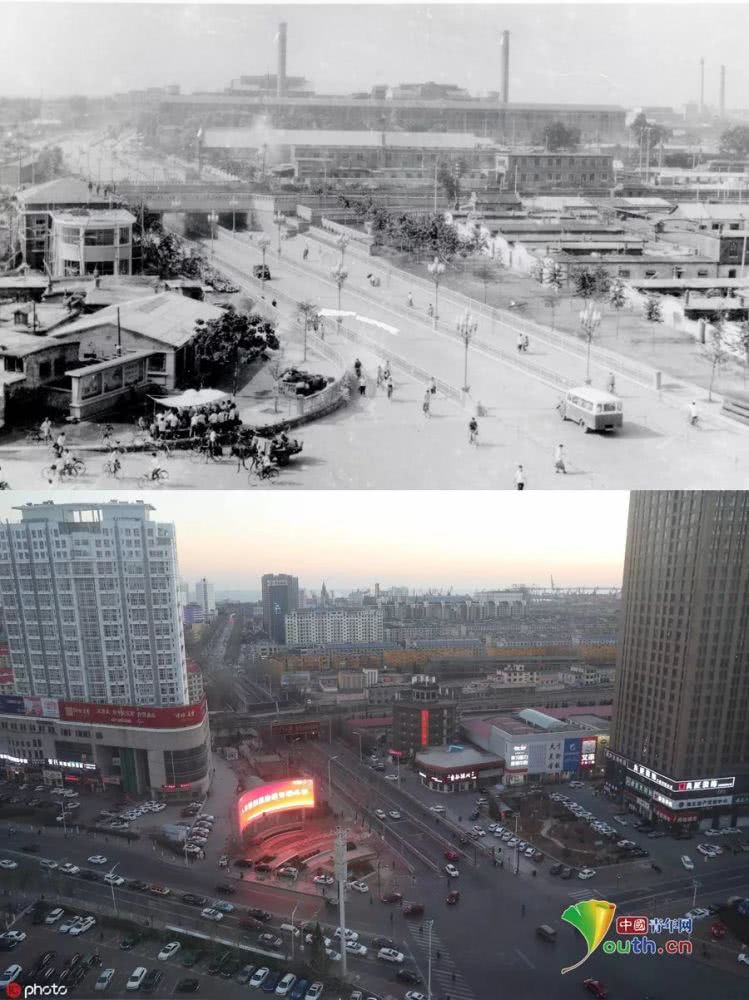
Above: The old appearance of the South of Wenhualu Road in Haigang District in 1983 (Provided by Qinhuangdao City Archives)
Below: Intersection of Wenhualu Road, Haigang District, December 13, 2018 (Photo by Cao Jianxiong)
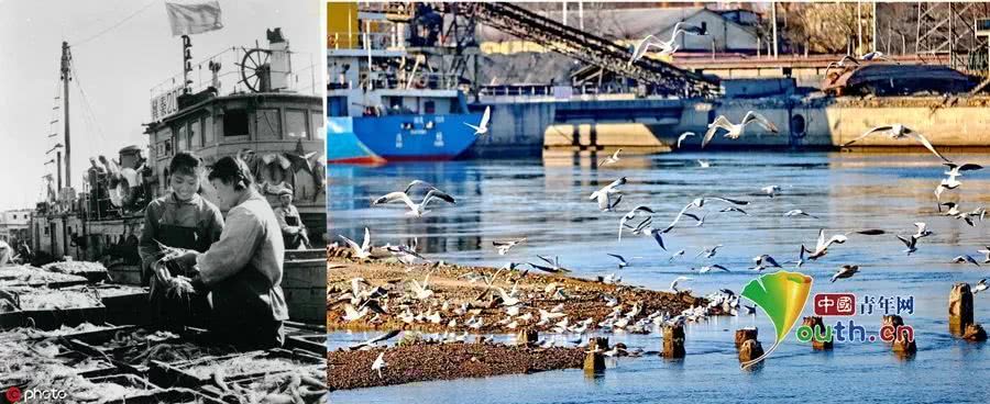
Left: Qinhuangdao Fishing Ship Dock, 1979 (Provided by Qinhuangdao City Archives)
Right: Qinhuangdao Fishing Ship Dock on February 9, 2017 (Photo by Cao Jianxiong)
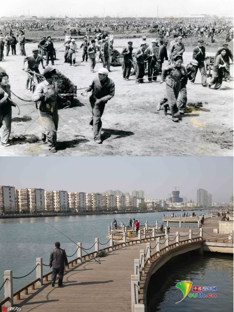
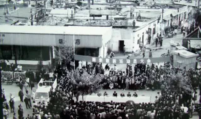
Above: On April 17, 1970, Qinhuangdao City built a fishing ship dock at the Xinkai River mouth to mobilize the mass of the city to volunteer. (Provided by Qinhuangdao City Archives)
Below: Xinkai River, Haigang District, April 22, 2015 (Photo by Cao Jianxiong)
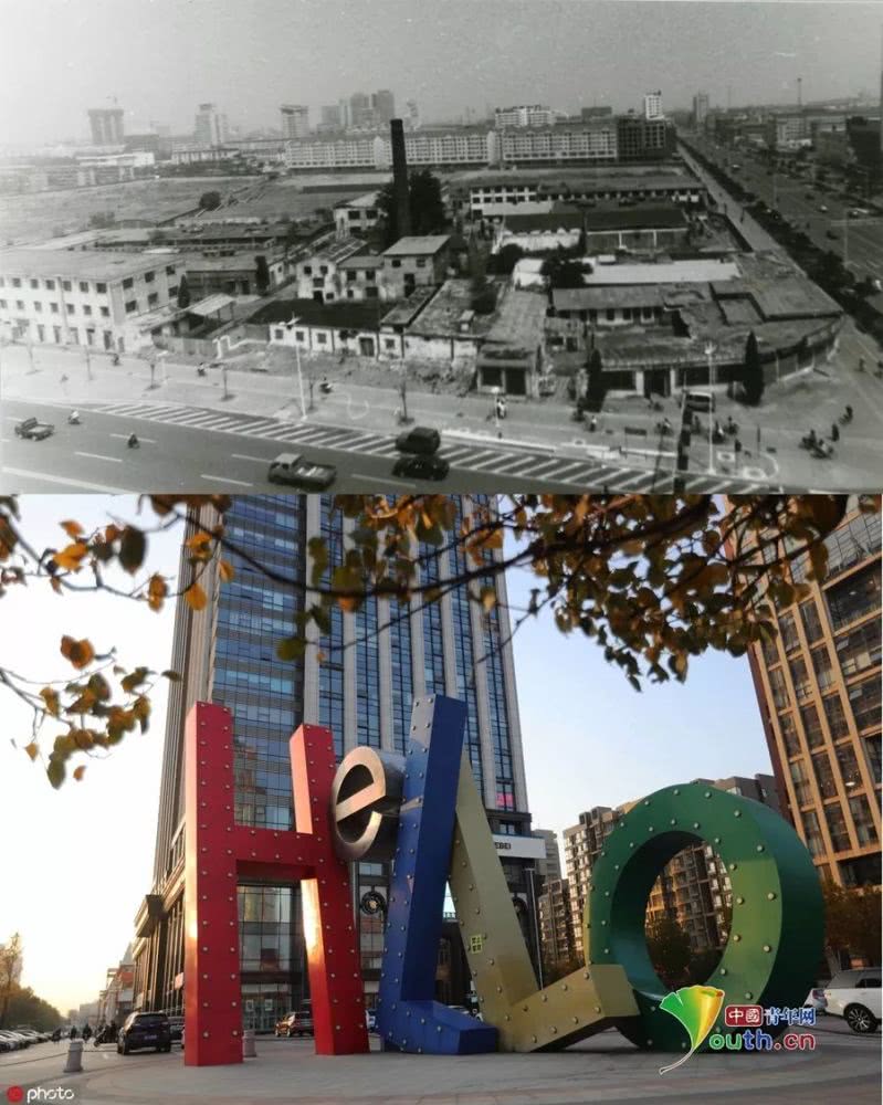
Above: Bayi Color Weaving Factory Area in the Haigang District, Fuwu Li (west of Wenhua Road and north of Jianshe Street) (Provided by Qinhuangdao City Archives)
Below: On the northwest side of the intersection of Wenhualu Road and Jianshe Street on November 11, 2018 (Photo by Cao Jianxiong)
Whether it is prosperous or lonely, it has already in the passed time. Every corner of the city is engraved with the stories of the past. This is why we cherish it. Life may come to an end, but the story will not stop, and these streets are the best recorders.
Note: The above text, information and pictures are from Qinhuangdao Library, Tangshan Fengwu(Styles and Characters), Qinhuangdao Impression, Today’s Report and Network of Qinhuangdao TV Station. Thank you for your efforts. The copyright belongs to the original author. If there is any infringement, please contact us and we will delete it immediately.
International Channel
http://www.qhdnews.com/en/index/
International Channel Mobile Client
http://www.qhdnews.com/en/mobile
Chinese manuscript